Showing posts with label Tourism. Show all posts

Thursday, May 11, 2023

Hiking Through the Mossy Forests of Mt. Molmog in Bauko, Mt. Province

After three hours and a half of navigating through the tricky and winding roads of the Halsema Highway, the two vans finally stopped at the jump-off point for Mt. Molmog in Bauko, Mt. Province. A motley group of around 30 hikers have come to this place for a tree-planting/camping event organized by the town through Jomar Buclay and the Bauko Municipal Environment and Natural Resources Office (MENRO). 

The sun was yet to make its grand entrance in the horizon and we were at an altitude which can be fairly considered as moderate to high. That said, it was cold. The good news was there was hot coffee and bread waiting for us at the jump-off point. We took our time to shake off the morning jitters of the long drive from Baguio City. After a quick orientation, the hike commenced. It started to get warm as the sun inched higher above the surrounding mountains.

At the start of the trek, each hiker was given a bamboo seedling or two. We were to plant these at a section of the trail going to Mt. Molmog. Planting the trees went smoothly. All trees were planted firmly into the ground within an hour or so. With the planting done, the focus now was to make it to the summit of Mt. Molmog which is basically a grassy patch of land which also serves as a camping ground. 

Mt. Molmog isn't a difficult climb. Its trails are a perfect blend of moderate ups and downs. As long as you're fit, the hike to the summit should be a breeze. I didn't track how long it took us to reach the summit from the jump-off point but I'd say it was between 3-4 hours. Most of the time, you will be hiking through a thick mossy forest with grassy clearings here and there. Jump-off to summit measures approximately 9 to 10 kilometers.

At the summit, there's more than enough space for 8-10 camping tents. Tents in excess can set up camp in the surrounding forest. Which was exactly what we did. Some pitched their tents over the grassy clearing at the summit. Others pitched theirs in the surrounding forest.

We had pinikpikan for dinner. And some drinks, of course. Then everybody settled in for the night. It wasn't as cold as I expected during the night. Based on my experiences camping and pitching tents in similar mossy mountains in Kabayan and Bokod, it can be freezing cold at night. That wasn't the case here. It was cold but not freezing cold. I slept rather soundly for a change.

Everybody woke up early the next morning to watch the sun rise. It was beautiful as you would expect. Sunrises and sunsets are always a sight to behold here in the Cordilleras. A sea of clouds sometimes occur in Mt. Molmog. Unfortunately, we didn't see one when we were there. Maybe next time. 

We then had a little breakfast. Then the descent down the mountain. 

[P.S. - There's a mountain trail run to be held there this coming July. The race route will pass through Mt. Molmog. Just search for "Mountain Ridge Run" on Facebook for the complete details. See you there!]
      

Tuesday, March 10, 2020

All Hiking Activities In Mt. Ulap Suspended Until Further Notice

The officials of barangay Ampucao in Itogon, Benguet have decided to suspend all hiking and tourism activities in Mt. Ulap and its various eco trails. The temporary suspension is a preventative measure against the current corona virus threat.

The barangay announced the closing of the mountain today (Tuesday). Organizers and hikers who are scheduled to climb the mountain in the coming weeks are advised to follow the directive. There's no definite date on when the mountain will be reopened. Given the increasing number of corona virus cases in the country, it will probably be a while before the barangay allows hikers to enter the area.


It can be recalled that Mt. Ulap was closed a couple of weeks ago, also because of the corona virus threat. It was reopened in the last week of February. The local officials decided to close it again today for the safety of the residents. A lot of the hikers climbing Mt. Ulap often come from the NCR. As of this writing, more than a dozen cases of the corona virus have been recorded in the NCR.

Wednesday, February 12, 2020

Kabayan To Close All Tourism Sites As Preventive Measure Against Threat Of Novel Coronavirus

In an advisory dated February 12, 2020, the town of Kabayan in Benguet announced that they are closing all tourism sites as well as suspending all tourism activities within the town as a preventive measure against the threat of the Novel Coronavirus. The shutting down of tourist sites will take effect on February 24.

Tourism activities within the town are still allowed until February 23. However, all tourists and tour organizers/coordinators are requested to abide with the executive order which urges them to declare that they haven't traveled to countries wherein there were confirmed cases of the virus. They will only be allowed to enter the town with the proper disclosure.

A week ago, the town cancelled their Date with the Peak event which was supposed to happen on February 25 to 27. This trek was supposed to take trekkers to Mt. Pulag via the Tawangan Trail.

Photo by Daniel Ted C. Feliciano
Aside from Mt. Pulag, other tourism sites in Kabayan include Mt. Tabayoc, the four Mystical Lakes, and a few ancient burial caves.

Monday, June 25, 2018

How to Get to Barangay Poblacion in Bakun, Benguet

This is a quick guide for tourists, hikers, climbers, or anyone who wants to know how to get to barangay Poblacion in Bakun, Benguet. Poblacion is the tourism center for the town for the simple reason that the barangay serves as the jump-off point for majority of the tourist destinations in the region. It’s also the base camp for hikers climbing the famous Bakun Trio (Mt. Tenglawan, Mt. Lubo, and Mt. Kabunian).

If You Are Commuting
The only public transport vehicle that goes to Poblacion is a single bus that departs from La Trinidad, Benguet between 6:00 and 7:00 in the morning. If I remember correctly, the bus waits for passengers at the parking lot of Kenwayne Commercial in Km. 6, La Trinidad. For those not in the know, La Trinidad is a Benguet town neighbouring Baguio City. By jeep, La Trinidad is just 20 minutes to 1 hour away from the city depending on vehicular traffic.

Anyway, you must be at the Kenwayne Commercial parking lot before 6:00 am to make sure that you have a seat in the bus. I repeat, there’s only one bus that plies the La Trinidad – Poblacion route. Well, there are actually two buses but the other one departs from Poblacion and heads to La Trinidad. Bus seating is on a first-come, first-serve basis. Fare is around 185 to 200 pesos per passenger. The route follows Halsema Highway until Sinipsip in Buguias, Benguet. From there, the bus takes another road that leads to Poblacion. Travel time from Baguio City/La Trinidad to Poblacion is between 5 to 7 hours.

If You Are Driving Your Own Car
If you have your own car, there are two routes you can follow. The first one is the same as the route of the public bus. From Baguio City, head to La Trinidad, follow Halsema Highway all the way to Sinipsip, Buguias. From there, look for the diversion road that leads to Bakun. It’s easy to spot because there’s a huge sign that says “To Bakun”. Or just ask the locals there. The second route is through Kapangan and Kibungan. This route is a little bit harder to follow because of the many diversions road branches along the way. If you are not familiar with the route, you will have to stop often to ask locals if you are on the right direction towards Bakun.
Layan Rice Fields in Poblacion, Bakun. Photo by Daniel Feliciano/The Cordilleran Sun

The Condition of the Road to Poblacion, Bakun, Benguet
Majority of the road is paved. Whether you are taking the Halsema Highway route or the Kapangan-Kibungan route, the road is cemented and mostly in good condition. Of course, you will encounter patches of rough road every now and then courtesy of ongoing construction and widening projects. The few kilometres going down to Poblacion itself are probably the roughest parts of the road. The road is often narrow and unpaved.

How Many Hours to Poblacion, Bakun?
The bus usually takes between 5 to 7 hours to get there. That’s understandable since it often stops along the way. Private vehicles can get there for as short as 4 hours.

Is There a Bus from Poblacion, Bakun to La Trinidad or Baguio City?
Yes, there’s a bus that departs from Poblacion every morning between 6:00 and 7:00 am. It’s the only bus trip so make sure that you catch it early. The bus stops in the town of La Trinidad. If you are going to Baguio City, you will have to take a jeep or a taxi from La Trinidad to Baguio City.

If you have further questions on how to get to Poblacion, Bakun, Benguet, feel free to ask in the comments section below. You can also follow us on Facebook and Twitter.

Saturday, June 23, 2018

Information for Tourists Planning to Visit Bakun’s Waterfalls, Mountains and Other Tourist Spots

If you are planning to head over to the municipality of Bakun in Benguet to climb its mountains or explore its numerous waterfalls, be aware that there’s a protocol you must follow. First of all, you should inform barangay Poblacion that you are coming. Barangay Poblacion is the town’s tourism center because it serves as base camp for majority of the visitors exploring the town’s tourist destinations. Give them a heads-up days before you travel there. The contact details of the people you should talk to are provided in the document below.

After arrival in Poblacion, it’s mandatory that you register, pay the necessary fees, and secure guides before you depart towards a tourist spot. The fees and rates are detailed in the following document.

Note: This is a document I copied verbatim from files sent to me by the Barangay Tourism Council. If you think there are errors or inconsistencies with it, please direct your inquiries at the Barangay Tourism Council, not to me.
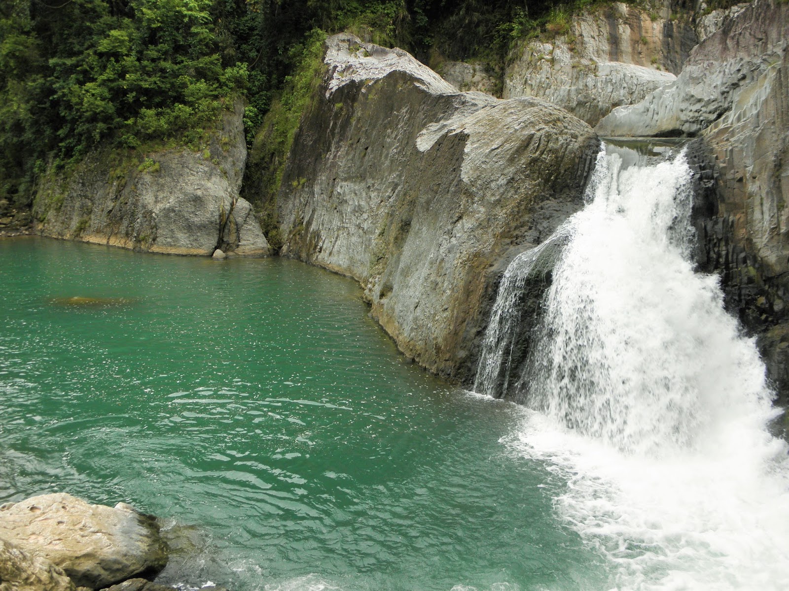
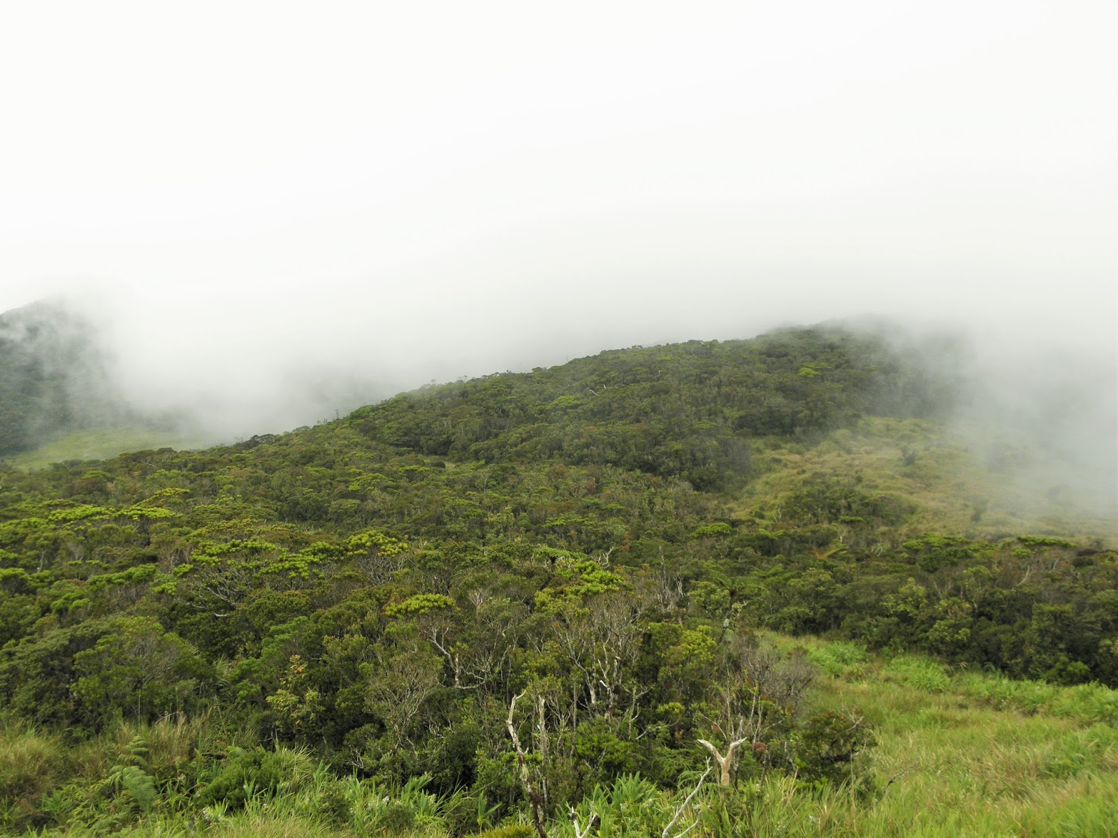
Pattan Falls in Poblacion, Bakun, Benguet. Photo by Daniel Feliciano/The Cordilleran Sun
Barangay Tourism Council (BTC)
Poblacion, Bakun, Benguet

I. Pre-Departure
Visitors are advised to contact the Municipal Tourism Officer or the barangay government of Poblacion/Sinacbat, Bakun, Benguet.

Contact Persons:
Mr. Arthur A. Tolito – 09212113687/09053172616 (Municipal Tourism Officer)
Ms. Nenita A. Budas – 09183523722 (BTC President)
Mr. Peter A. Diclas – 09303625434 (Tour Guide Coordinator for Mt. Kabunian)
Ms. Mylene Toanen – 09098709002 (Tour Guide Coordinator for Mt. Lobo and Nagasa Cave)
Mr. Myrick Losente – 09128083649 (Tour Guide Coordinator for Mt. Tenglawan)

II. Arrival
All hikers visiting the Bakun Trio and other tourist spots should drop by at the Tourist Assistance Center located at the Barangay Hall to register, secure permit, pay necessary fees and be given a briefing. However, hikers going to Mt. Lobo and Nagasa Cave using the Dada route (traverse to Poblacion proper, base camp) are advised to register and pay environment fee at the Dada Multi-Purpose Building. Hikers going to Mt. Tenglawan using the Sinacbat route is likewise to follow same protocol above upon arrival to Poblacion proper.

Registration per person includes paying the fee rates as follows:

Environmental and Registration Fees:
Mt. Tenglawan – 100 per person
Mt. Kabunian – 100 per person
Mt. Gedgedayan – 100 per person
Mt. Lobo – 100 per person
Nagasa Cave – 100 per person
Mt. Lobo and Nagasa Cave – 100 per person
Tekip Falls – 50 per person
Pikaw Falls – 75 per person
Pattan Falls – 75 per person
Sakup Falls – 75 per person
Bagiw River – 50 per person
Mangta Falls – 75 per person

Tour Guide Fees
Hikers are required to engage with a tour guide in a ratio of 1-6 individuals. If you exceed 6 individuals, you will have to pay the guide 100 per excess. But you should not exceed 8 individuals. If you are beyond 8 individuals, you are going to need two guides.

The rates per tourist site are as follows:
1. Poblacion – Mt. Tenglawan - Poblacion: 12 hours, 1300 per guide, 3:00 am the earliest departure
2. Poblacion – Mt. Kabunian - Poblacion: 8 hours, 1000 per guide, 4:00 am the earliest departure
3. Poblacion – Mt. Lobo/Mt. Patullok – Poblacion: 7 hours, 900 per guide
4. Dada – Mt. Lubo/Mt. Patulok – Dada: 6 hours, 600 per guide
5. Dada – Mt. Lubo/Mt. Patullok – Poblacion: 7 hours, 800 per guide
6. Poblacion – Mt. Tenglawan – Poblacion: 12 hours, 1300 per guide
7. Sinacbat – Mt. Tenglawan – Sinacbat: 8 hours, 800 per guide
8. Sinacbat – Mt. Tenglawan – Poblacion: 12 hours, 1300 per guide
9. Poblacion – Nagasa Cave – Poblacion: 8 hours, 600 per guide
10. Dada – Mt. Lobo/Mt. Patullok – Nagasa Cave – Poblacion: 10 hours, 1200 per guide
11. Poblacion - Mangta Falls - Poblacion: 7 hours, 700 per guide
12. Poblacion - Pattan Falls - Poblacion: 6 hours, 600 per guide
13. Poblacion - Mt. Gedgedayan - Poblacion: 8 hours, 1000 per guide

Note: When the duration set for the route exceeds the target number of hours, there is an additional fee of 50 pesos per hour for Mt. Kabunian and Mt. Lubo while 100 pesos per hour for Mt. Tenglawan.

Tekip Falls: 300 per guide. Tour is maximum of three hours. For every excess of one hour, add 50 pesos.
Bagiw River: 250 per guide. Tour is maximum of three hours. For every excess of one hour, add 50 pesos.
Pikaw Falls: 500 per guide. Tour is maximum of five hours. For every excess of one hour, add 50 pesos.
Sakup Falls: 400 per guide. Tour is maximum of five hours. For every excess of one hour, add 50 pesos.
Pattan Falls: 500 per guide. Tour is maximum of six hours. For every excess of one hour, add 50 pesos.
Mt. Kabunian (from barangay Kayapa/Kibungan) to Poblacion: 800 per guide
Poblacion – Mt. Kabunian – Kayapa/Kibungan – 800 per guide

Package 1: Poblacion – Mt. Kabunian plus Pattan Falls. Pass through the Hedcor Inc. conveyance line.: 1000 per guide

Package 2: Tekip Falls, Bagiw River, Pikaw Falls, Sakup Falls, Layaan Rice Terraces, Burial Caves along Sapid, Layaan and Lutaan: 1000 per guide, valid for one day

Package 3: Tekip Falls, Bagiw River, Layaan Rice Terraces and Burial Caves along Sapid, Layan, and Lutaan: 600 per guide, valid for one day

Package 4: Sakup Falls, Pikaw Falls, Bagiw River, Rice Terraces and Burial Caves along Sapid, Layan, and Lutaan: 950 per guide, valid for one day

Package 5: Bagiw River, Rice Terraces and Burial Caves: 250 per guide

Package 6: Mt. Kabunian plus Gawaan Rice Terraces, Beey Kawit Falls, Hanging Bridges, Bagiw River and Burial Caves: 1000 per guide, valid for a day

Package 7: Mt. Kabunian plus Pattan Falls, Gawaan Rice Terraces, Hanging Bridges, Beey Kawit Falls, Bagiw River and Burial Caves: 1200 per guide, valid for one day

Package 8: Mt. Gedgedayan plus Pikaw Falls, Bagiw River, Burial Caves and Rice Terraces along Sapid, Layan, and Lutaan: 1400 per guide, valid for one day

Package 9: Pikaw Falls and Bagiw River: 600 per guide, six hours

Package 10: Mt. Gedgedayan and Pikaw Falls: 1200 per guide, valid for a day

For Overnight in the Tourist Spot:
Mt. Lubo: 1100 per guide
Mt. Kabunian/Mt. Gedgedayan: 1300 per guide
Poblacion – Mt. Tenglawan – Poblacion: 1800 per guide
Poblacion – Mt. Tenglawan – Sinacbat: 1800 per guide
Sinacbat – Mt. Tenglawan – Sinacbat: 1300 per guide
Sinacbat – Mt. Tenglawan – Poblacion: 1800 per guide
Tekip Falls: 750 per guide
Bagiw River: 750 per guide
Pikaw Falls: 800 per guide
Sakup Falls: 800 per guide
Pattan Falls: 1000 per guide

Porter’s Fee:
Same as tour guide fee.

Note: Maximum load is 20 kilograms plus 20 pesos in excess per every one kilogram. Load per porter should not exceed 25 kilograms.

Services Fee/Camping Fee
Inside and or outside the Old Municipal Building/Open Market Building: 80 pesos per person per night for maintenance, water, and electricity.

For Hire Items from the Barangay Government and Tour Guides Association
1. Blanket: 40 per night
2. Mat: 40 per night
3. Pillow: 20 per night
4. Mattress: 40 per night
5. Sleeping bag: 40 per night
6. Earth pad: 40 per night

Note: All the fees will be collected at the tourist assistance center (barangay hall) upon registration.
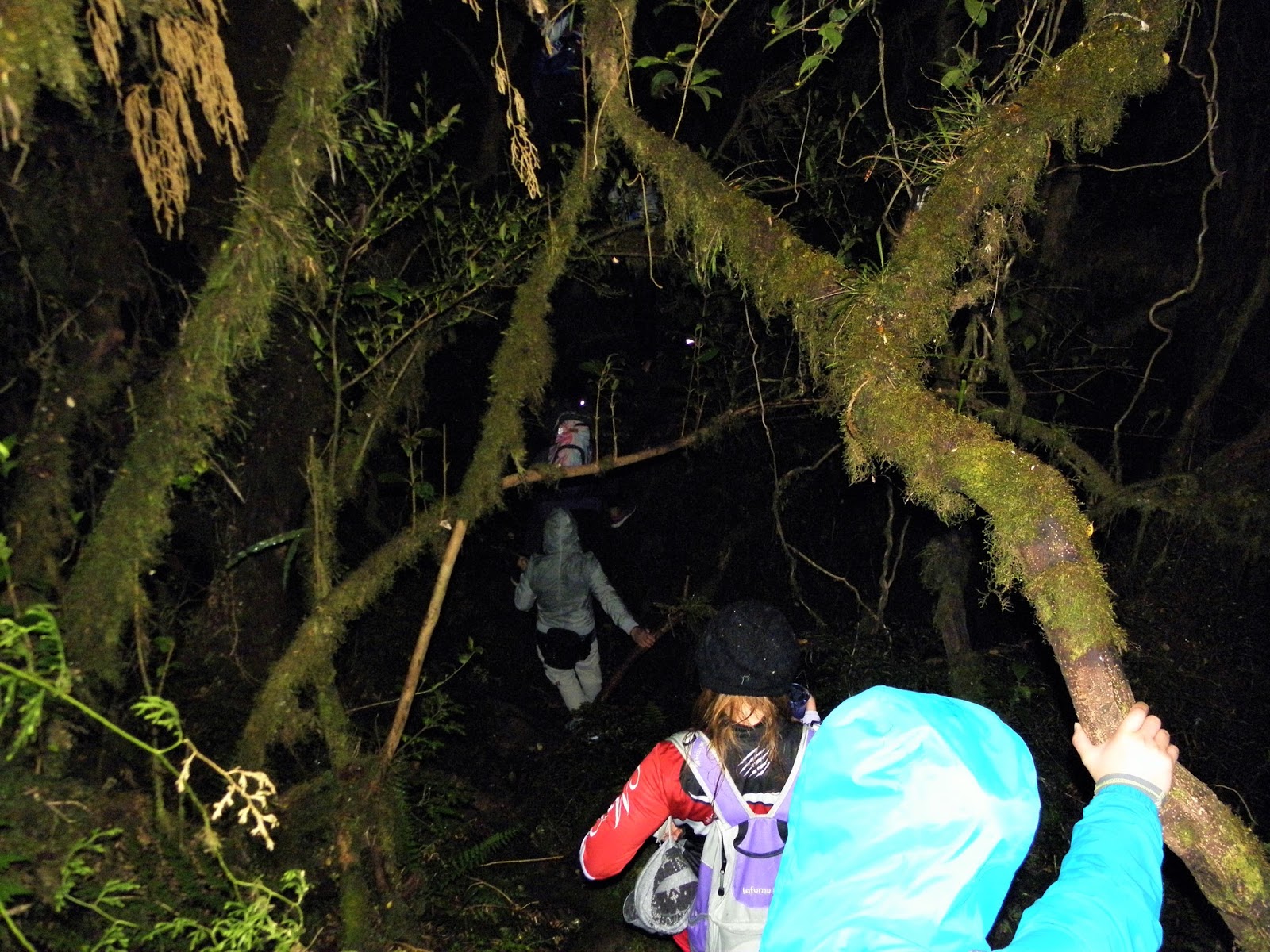
III. Hiking
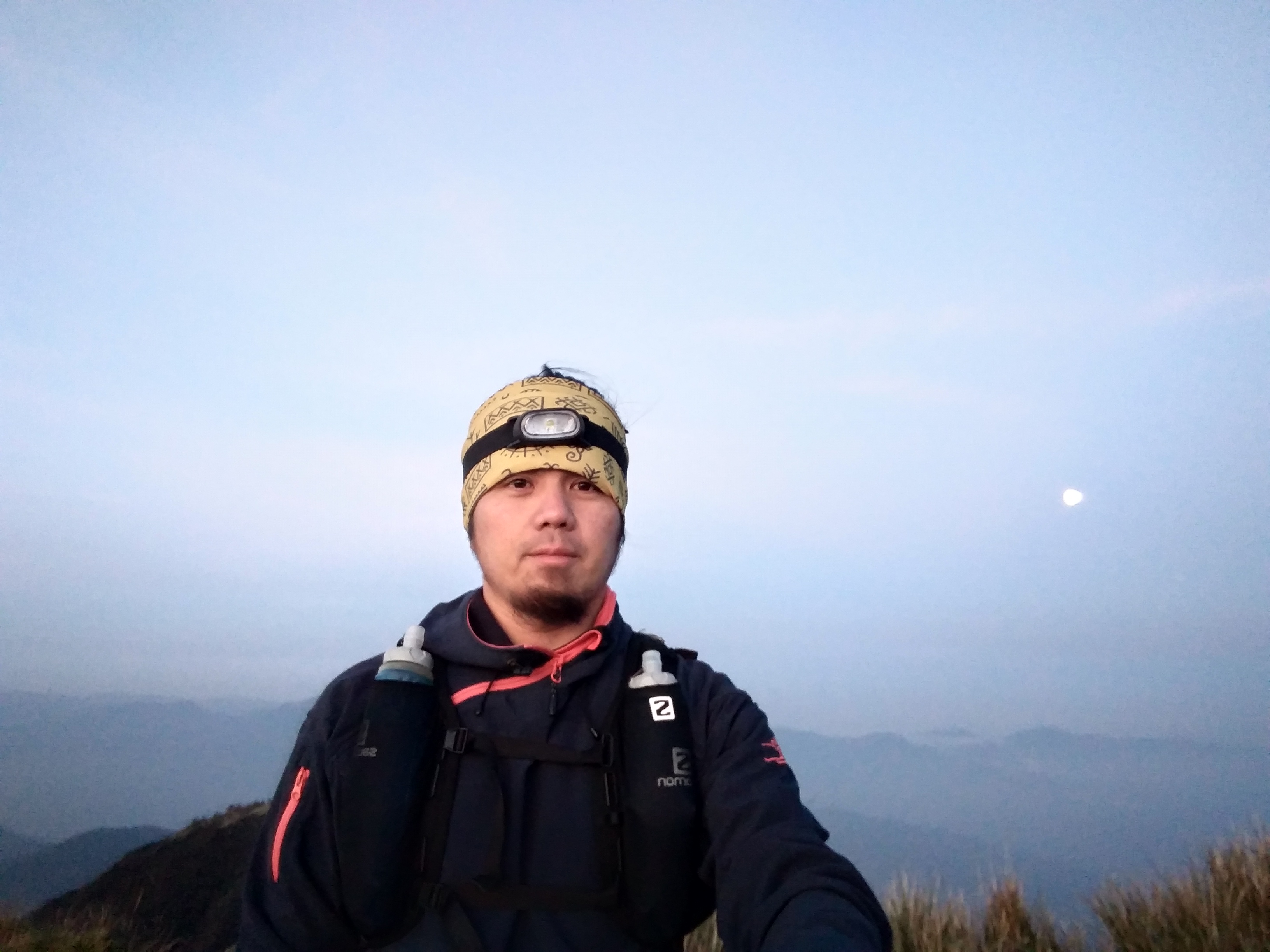
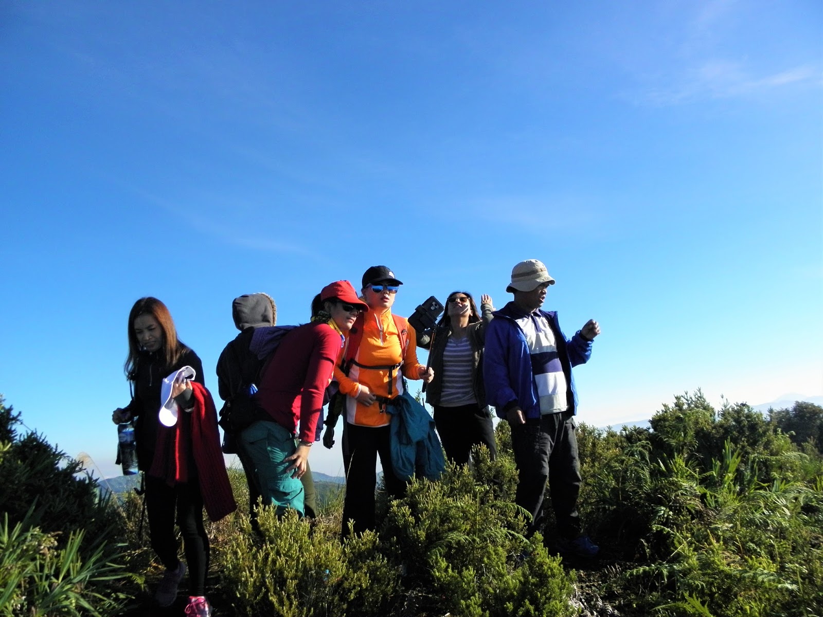
Hikers/hiking groups have their own set of rules to follow. However, while inside the Bakun Trio, you are advised to follow these pointers:
1. Hikers must designate strong hikers (especially for big groups) who could act as sweepers to take care of slow hikers.
2. All hikers must always be guided by the mountaineer’s credo: take nothing but pictures, leave nothing but foot prints, and kill nothing but time.
3. For trail junctions where there are no trail signs, advance group members should make temporary directional signs for others to follow.
4. No hikers are allowed to bring with them liquor and dangerous drugs.
5. For smokers, properly put off cigarettes to avoid forest fires.
6. Hikers who camp in the tourist sites must construct their tents at the designated camp site.
7. Fill up water bottles before hiking. In areas where springs are available, the water is potable for people who do not have sensitive stomachs.
8. Respect the indigenous people’s culture. The culture may be different from yours but it is their culture. You are in their cultural ground.
9. Hiking should be fun. It is not a race. Take time to enjoy what nature offers. It is free.
10. Lastly, safety first at all times.

Saturday, April 7, 2018

7 Must-See Waterfalls in Benguet

Within a few weeks from now, the rainy season will be bearing upon us at full speed. As water cascades down the hills, mountains, creeks, and streams, our rivers swell to their highest levels. For those looking for a little bit of watery adventure, it’s the perfect time to go chasing waterfalls. So without further ado, I present to you some of the best waterfalls that the province of Benguet has to offer. [Note: This list only includes those waterfalls I’ve personally seen.]

1. Mangta Falls (Bakun) – You have to hike for about an hour from Poblacion, Bakun to reach this waterfall which also happens to be located in the foot of the mountain range that’s topped by Mt. Tenglawan. For thousands of years, the waterfall pounded on the solid rock below creating a small but deep pool of water. Swimming at the pool is not advisable during the rainy season as the waters turn into a churning cesspool of strong and dangerous currents. To get a full view of Mangta Falls, you need to make your way up Mt. Gedgedayan or Mt. Kabunian. You don’t have to climb all the way to the top. Just get to a point in the trail wherein you’re at least within eye-level with the falls.

2. Tekip Falls (Bakun) – Probably one of the best waterfalls I’ve ever personally seen. However, the waterfall is a hit-and-miss. During the summer months, it dries up to the point that all you see is a trickle of water. But during the rainy months, it’s a complete beauty. When bathing under it, you have to be careful because of the pressure and the chance that there may be debris falling along with the water.

3. Bayokbok Falls (Tublay, La Trinidad) – Just a few kilometres away from Poblacion, La Trinidad, Bayokbok is composed of one big waterfall and two smaller layers above it. The waterfall is located just a stone’s throw away from the Asin hot spring. Just make your way to the hanging bridge, follow the trail, hit a small road and ask the locals for the final direction to the waterfall. It’s nice going there during the summer months because the waters turn pristine blue. During the rainy season, the waterfall is a magnificent gurgling beauty but the blue waters are transformed into chocolate brown.

4. Badi Falls (Kapangan) – This is actually a series of more than four picturesque waterfalls. You make your way to the riverbed at the foot of a mountain then slowly creep your way up river. Each waterfall is but several minutes away from each other. We’ve been there a month or so ago and the river current is still decent enough albeit the absence of rains. I’d like to go back there when the rainy season is in full swing and the river current doubles or even triples.

5. Pattan Falls (Bakun) – We made a quick side trip to this waterfall after we summited Mt. Kabunian. The water here is not that strong but apparently it grows dangerously strong during a typhoon. In fact, the hanging bridge which runs across just below it is a mangled mess of twisted metal and wires. I can only presume that it got torn to pieces by the raging waters during a storm.

6. Kitong Falls (Tublay) – Just like Tekip Falls, this waterfall dries up to a trickle during the summer season. When we went there, it was April I think so there was no water. All that was left was a great pool of stagnant water at the foot of it. Nevertheless, this is a nice side trip for those who visit the Bengaongao and Paterno Caves in Ambongdolan. The waterfall is just a few minutes’ walk away from the entrance to Bengaongao Cave.

7. Pajekpek Falls and Suyok Falls (Dalupirip, Itogon) – I didn’t personally see this waterfall but I’ve heard from a few acquaintances that it’s quite good. I’m taking their word for it. All I know of the waterfall are a couple of photos that I’ve seen online. We were supposed to go there a week or so ago after our hike up Mt. Pigingan but we didn’t have enough time. Supposedly, the waterfall is about an hour away from the section of Agno River at the jump-off point. Dalupirip would be the perfect place for a waterfall. Imagine dipping in the cool waters after a hot and sweaty hike.

So there you go. If you think I missed something or if you have something to add, feel free to chime in at the comments section below.

Tuesday, January 2, 2018

Panagbenga Festival 2018 Schedule Of Events

With less than four weeks to go, the 23rd edition of the annual Panagbenga Festival is right around the corner. With the theme "Celebration of Culture and Creativity", the city aims to showcase once again its status as one of the most culturally-rich urban centers in the country. It also happens that the city is just a couple of months removed from being declared a "creative city" by the United Nations.

The festival will kick off with an opening ceremony on the first day of February. The highlights of the celebrations will be the Grand Street Dance Parade and Grand Float Parade that will happen on February 24 and 25, respectively. Below is the schedule for the main and traditional events of the festival. This schedule doesn't include events and activities organized by parties other than City Hall and the official festival organizers.
Date
Event
Venue
February 1
a.      Panagbenga Opening Ceremony and Parade
b.      Drum and Lyre Competion – Elimination Round (Elementary Division)
Panagbenga Park – Session Road – Athletic Bowl
February 1 – March 4
Baguio Blooms Exposition and Exhibition
Juan Luna and Lake Drive in Burnham Park
February 11
a.      Handog ng Panagbenga sa Pamilya Baguio
b.      Let a Thousand Flowers Bloom
c.       Panagbenga Open Kite Flying Competition
d.      Panagbenga Cultural Show
Melvin Jones Grandstand and Football Grounds
February 14
a.      School-based competitions
b.      Floral arrangement contest for elementary and high school
School campuses
February 15 – February 17
a.      School-based competitions
b.      Landscaping competition
School campuses
February 16 – February 18
PMA Alumni Homecoming Weekend
Philippine Military Academy
February 16
Flower Tee Open Golf Tournament
Baguio Country Club, Camp John Hay
February 17
Spring Festival/Chinese New Year
City-Wide
February 24
Grand Street Dance Parade
Panagbenga Park, Session Road, Maharlika, Harrison Road, Athletic Bowl
February 24 – February 25
Exhibitors and Sponsors Day
Ganza Parking Area
February 25
Grand Float Parade
DILG, Session Road, Maharlika, Harrison Road, Melvin Jones Football Grounds
February 26 – March 4
Session Road in Bloom
Session Road
March 3
Pony Boys Day
Wright Park
March 4
a.      Closing Ceremonies and Awarding
b.      Grand Fireworks Display
Baguio Athletic Bowl

Thursday, December 14, 2017

The Endangered Mossy Forests of Kabayan, Benguet

Through a message sent by a concerned reader, it came to my attention that the mayor of the nearby town of Kabayan in Benguet seems to be serious about the idea of cancelling out the declaration of Mount Pulag as a protected national park. The mountain and its surrounding forests were declared as a national park back in 1987. This declaration was instrumental in protecting the mountain and the surrounding forest reserves.

Now, Gideon Todiano, Mayor of Kabayan wants this declaration nullified. If he pursues this, it would be very bad for the park. In an article published by the Bombo Radyo Baguio website, Todiano cites problems with the management of the park as among the reasons why he’s adamant about the issue. He also cites the unclear role of the town in managing the park, unresolved land claims, and millions of pesos of unpaid taxes due to the unresolved land claims.

Todiano raises a lot of valid points here and these are really serious matters but I don’t think that removing Mt. Pulag’s tag as a national park will resolve the issues. In the short-run, maybe. But in the long-run, it will be disastrous not only to the mountain and the surrounding forest reserves but to the town of Kabayan as well. With that said, I hope that Todiano, the town, and the Department of Environment and Natural Resources talk over things and resolve issues without resorting to this bizarre idea of undeclaring the place as a national park.

And let us not forget that the Mt. Pulag National Park covers not just Mt. Pulag itself but numerous mountains and forests within Benguet, Ifugao, and Nueva Vizcaya.

Early this year, we climbed Mt. Tabayoc and explored the nearby lakes and mossy forests in Ballay, Kabayan. These places are still parts of the Mt. Pulag National Park. Huge swaths of the mossy forests have already been converted into farm lands. The speed of how forests are turned into farm lands can double or even triple if the place is no longer a national park. It will be open season for everyone.

Of course, it’s understandable that the people in Kabayan need land to farm. But let’s not forget that Pulag, Tabayoc, the lakes, and the mossy forests are watersheds. If these forests are gone, there’d be no source of water to irrigate the farm lands. There should be balance in everything. These are the only remaining mossy forest covers in the province. Again, I’m hoping that Todiano, the town of Kabayan, and the DENR resolve issues surrounding the park without having to “undeclare” it as a national park. I'm confident that they can come up with solutions that will protect both the mountains, the mossy forests, and the interests of the town's citizens.

Here are some photos from the trip we made in Mt. Tabayoc in Ballay, Kabayan several months ago. The place is beautiful with its mossy forest covers and lakes. These places are worth saving and protecting.


Wednesday, November 1, 2017

Baguio City Designated as a CREATIVE CITY by the UN Educational, Scientific, and Cultural Organization

Consider this as yet another feather in Baguio City's ever colorful cap. In a much-awaited announcement, the United Nations Educational, Scientific and Cultural Organization (UNESCO) designated Baguio City, along with 64 other cities from 44 countries, as a "Creative City". With the designation, Baguio City is officially joining UNESCO's Creative Cities Network. Established in 2004, this network promotes "cooperation with and among cities that have identified creativity as a strategic factor for sustainable urban development".

In their statement which was released on Tuesday (October 31), UNESCO said that the Creative Cities Network is at the frontline of the agency's "efforts to foster innovation and creativity as key drivers for a more sustainable and inclusive urban development". UNESCO Director-General Irina Bokova added that the new additions to the network "showcase an enhanced diversity in city profiles and geographical balance, with 19 cities from countries not previously represented in the network".

Baguio City is the first urban center in the Philippines to join the network. To become a member, interested cities must "submit an application that clearly demonstrates their willingness, commitment and capacity to contribute to the objectives of the network". The call for applications for this year was launched back in February. Baguio City was short-listed just last month (September). The network is composed of seven fields: Music, Media Arts, Literature, Gastronomy, Film, Design, and Crafts & Folk Art. Baguio City was designated as a "creative city" under the Crafts & Folk Art field.
Photo by Daniel Feliciano

The Goals of the Creative Cities Network [Source: CCN website]

By joining the Network, cities commit to sharing their best practices and developing partnerships involving the public and private sectors as well as civil society in order to:

1) strengthen the creation, production, distribution and dissemination of cultural activities, goods and services;
2) develop hubs of creativity and innovation and broaden opportunities for creators and professionals in the cultural sector;
3) improve access to and participation in cultural life, in particular for marginalized or vulnerable groups and individuals;
4) fully integrate culture and creativity into sustainable development plans.

Monday, August 21, 2017

Hiking Mt. Pigingan in Dalupirip, Itogon, Benguet

It was already pitch black when we reached the rather quiet and secluded barangay of Dalupirip. Situated in the outskirts of Itogon in Benguet, the place has a certain kind of charm to it. Maybe it’s the stillness in the air. Maybe it’s the clear sky bursting with stars. Maybe it’s the sound of rushing waters at the mighty Agno River. The place reminded me of home – Besao, Mt. Province. The magic of rural living was everywhere.

I was in the company of new friends who, just a few hours ago, were nothing short of strangers: Edu, Ivan, Junie, Ana Fe, Shin Joy, Natazzia, and Angelique. They were a team of photographers, videographers, guides, and travellers bent on documenting the beauty of Dalupirip through an initiative by the Itogon Tourism Office. In a nutshell, we were there to help spread the word about the place.

Driving the white truck we were riding was no other than Mr. Joel Bauzon, the barangay captain of Dalupirip. He picked us up earlier at the Dangwa Station in Baguio City. The plan was to spend the night at a house near the magnificent Agno River then climb Mt. Pigingan before dawn breaks. Trekking early will make sure that we reach the summit in time to catch the sun as it rises out from the east.

The truck slowly swerved its way through the rugged road as we got closer to base camp. Every now and then we have to stop to open road gates. These are gates that prevent cattle (mostly cows and horses) from venturing into areas where they can inflict damage on properties and crops.

At around 9:00 in the evening, we reached the home where we’ll stay the night. Serving as our base camp was the house of manong Cruzaldo Atos. Manong Zaldo prepared for us a sumptuous meal of pinikpikan, brewed coffee, malunggay leaves, and a few other vegetables the names of which I can’t fully recall.

When the clock struck 11:00, we called it a night. Two of our companions retired inside the house. The rest of us preferred to sleep at the makeshift kubo outside. The kubo has open sides so we were at the mercy of mosquitoes and nasty small insects locally referred to by the Ibalois as sepsep. Our plan was to start the climb at 1:00 in the morning which means we only had two hours left for restful sleep.

We started the trek to Mt. Pigingan at exactly 1:30 in the morning. The first section of the trail isn’t that difficult as it follows a road currently under construction. The final trail to the summit is a bit more difficult but very manageable, even for beginners. It’s the rainy season so huge sections of the trail are wet and muddy. The trails are also often used by cows so the wet mud can be several inches deep.

Fortunately, Mt. Pigingan doesn’t have a leech (lamatik) problem. Dealing with leeches is a real struggle. I am reminded of the time we climbed Mt. Lubo in Bakun a few months ago. We had to stop every few minutes on the trail to pick off the leeches that latched onto our clothes.

After several hours of arduous climbing, we reached the summit of Mt. Pigingan. We were there moments before the sun peeked from the distant mountains. The summit is a thin grassy ridge punctuated by a few pine trees. When moving through the peak, you have to be very careful because the east side has a vertical drop which is dozens of meters high.

Suffice it to say that the views from the summit were magnificent. You have to be there to truly appreciate the beauty of the place. It’s highly recommended that you climb the mountain early in the morning, like we did. You’ll be treated with a fiery sunrise and a great view of the hills, mountains, rivers, and meadows below. If you climb too late, there’d be nothing to see but clouds and thick mists. The choice is yours: climb early or climb late.

And here are a few teaser photos from the trip. I say it again, you have to be there to truly appreciate the beauty of the place. These photos don't do justice to the wonders of nature that surround you once you step foot on the summit ridge.


Friday, July 21, 2017

Bayokbok Falls In Tuel, Tublay, Benguet

Bayokbok Falls is a waterfall located near the village of Tuel in Tublay, Benguet. If you are familiar with the Asin Hotspring in aforementioned village, Bayokbok Falls is just a few minutes away from it. Just cross the hanging bridge to the other side of the river then ask the locals for the direction of the trail that leads to the falls.

Or you can simply follow the river to the north until you reach the falls. However, before you decide to make your way through the river instead of following the trail, make sure that everyone in your group can swim. There are deep pockets and pools in the river that can be dangerous to non-swimmers. The rocks can also be very slippery (especially the moss-covered ones). If it's raining or it's about to rain, never follow the river because the current can suddenly swell to very strong levels.

How To Get To Bayokbok Falls In Tuel, Tublay
There are no jeeps that go directly to Tuel from either Baguio City or La Trinidad. At least that's what I know and what other people told me. However, there are these passenger cars commonly referred to as "garage" that ply the La Trinidad-Alapang-Alno-Tuel route. I'm not sure where they are parked or how their fare systems work. It's best that you get in touch with someone from Tublay to tell you exactly where and how you can hire a "garage" car to bring you to Tuel.

How Far Is Bayokbok Falls
When I went to the falls, I jogged and ran all the way from the Alapang Road - Halsema Highway intersection in Cruz, La Trinidad. It took me less than two hours to reach Tuel. I think the distance is about 12 to 18 kilometers. That said, by my estimate, I think you can reach Tuel in under an hour if you have a ride. The road is paved and in good condition. The road is all downhill from Cruz to Alapang, to Alno, then to Tuel.

If you are not a regular jogger or runner, I wouldn't recommend running your way to the falls. The run to the place is fine and I think most people can manage it. But the ascent from Tuel back to Cruz can be very difficult. I run regularly so I'm in a pretty decent condition but I found the ascent arduous and often difficult.

Photos of Bayokbok Falls:


Other places worth visiting in Tublay, Benguet are Paterno and Bengaongao Caves.

Friday, June 23, 2017

Bakun Trio Guide: Registration, Fees, Transportation, Itinerary, Etc.

Bakun Trio is the collective nickname given to three popular mountains in the town of Bakun in Benguet. These are Mt. Tenglawan, Mt. Kabunian, and Mt. Lobo. These mountains are adjacent each other so mountain climbers usually climb all three within three days (one mountain a day). For those who are planning to climb the Bakun Trio, here's a quick guide for you. You will find here information about registration fees, where to register, how to get there, and other important details.

Before You Go To Bakun
It's important that you contact the Municipal Tourism Officer of Bakun at least a week before your trip The Municipal Tourism Officer will then refer you to whoever is in charge of hikers in the villages of Poblacion and Sinacbat.

There are two main persons you should contact prior to going to Bakun. They are as follows:
1. Arthur Tolito [09212113687 or 09053172616]  - Mr. Tolito is the Municipal Tourism Officer of Bakun.
2. Peter Diclas [09296210448 or 09062847896] - Mr. Diclas is the President of the Bakun Trio Tour Guides and Porters Association (BATTOGAPA).

Get in touch with these people before you head over to Bakun. They will inform you about everything you need to know about scaling the Bakun Trio. The mountains in Bakun are considered as major climbs so you need to be prepared especially if you plan on climbing the three mountains. Condition your body prior to your trip. Go to the gym, jog, run, climb smaller mountains, just do what you need to do to prepare yourself physically.

How To Get To Bakun
There are two main drop-off points in Bakun. One is Poblacion which is the drop-off point that most climbers use. Poblacion is where you should go if you plan on climbing the three mountains. The second drop-off point is Sinacbat. This is the drop-off point you use if you plan on climbing only Mt. Tenglawan. Or if you want to hit the Mt. Tenglawan - Mt. Kabunian Traverse. The trip from Baguio City or La Trinidad to the town of Bakun takes between 5 to 7 hours.

There are two irregular buses that go to Bakun every morning. These usually leave between 6:00 am and 7:00 am. One parks at the Petron Gas Station along Km. 5 in La Trinidad, just in front of the Jollibee branch. The other one parks at the Kenwayen Commercial Center along Km. 6 in La Trinidad, just beside the Calajo Restaurant. Bus fare is 185 pesos per head.

Registration Fees And Other Fees To Be Paid
1. Environmental fee - 100 pesos per head
2. Tour guide fee - 1000 (Mt. Tenglawan), 800 (Mt. Kabunian), 600 (Mt. Lobo)

It's worth noting here that the ratio for guide to hikers is one is to six (1:6). If your group has seven or eight people, you will have to pay an additional 100 pesos per head for the guide. If you exceed eight people, you will be required to get a second guide.


Where To Stay In Bakun
The local government unit of Bakun has designated the old municipal building as base camp for mountain climbers. This building is located in Poblacion. You can stay and sleep their at night. The lodging fee is 90 pesos per head per night. There are also blankets, mats, pillows, and mattresses that you can rent between 20 and 40 pesos each. If your base camp is in Sinacbat, you will be housed at the Sinacbat Barangay Hall.

How Many Days Will It Take To Climb The Bakun Trio
It usually takes three days. One day for each mountain. However, you need to take into account your travel to Bakun. So all in all, the trip can take 4 to 5 days. The first and fifth day will be travel days. You can cut the duration of the trip by one day if you get to Poblacion early in the first day which means you will still have time to climb one of the three mountains.

Monday, June 19, 2017

Missing Korean Hiker In Cordillera Mountains FOUND ALIVE After 8 Days And 7 Nights Of Search Operations

The search is finally over. After eight days and seven nights of search and rescue operations, the Korean hiker who went missing in the mountains of Barlig in Mt. Province has been found. And he's alive. In an update from the Mountain Province Disaster Risk Reduction and Management Office, Choi Sung Kyu was found around noon by Joselito Tukyap (a local resident) in barangay Latang, Barlig. The man was hunting for wild honey when he came across the Korean tourist.

Choi will be transported to the Bontoc General Hospital tomorrow (Wednesday) or as soon as his health condition permits.

Choi went missing over a week ago when he tried to hike to Batad, Banaue through Mt. Amuyao. At one point, policemen as well as the Korean Embassy were able to contact him via mobile phone and asked him to divulge his location. He said he was near a big rock which prompted rescuers to head over to Ammiw and Furud where large rock formations can be found. The rescuers failed to locate him

For the next several days, a massive search and rescue operation was conducted involving more than 70 people. These include responders from the Sagada MDRRMC, responders from the PDRRMC, locals and volunteers from the Barlig MDRRMC, and over a dozen Korean nationals. The Philippine Army, the Philippine National Police, and the K-9 unit of the Cordillera DRRMC were also tapped to assist in the search and rescue operations.
© Daniel Feliciano / The Cordilleran Sun
In light of the incident, tourists and travelers are being advised to always get a guide especially for hiking trips in the Cordillera region. It's easy to get lost in Cordillera's mountains. Even locals and experienced climbers often find themselves lost in the region's thickly forested slopes. What more if you're a visitor who is unfamiliar with the region's terrain. Lesson from the incident: get a guide.

Friday, May 5, 2017

Hiking The Monkey Trails Of Mt. Tabayoc In Kabayan, Benguet

When deciding whether it's worth it (or not) to climb a particular mountain, you consider two very important factors: the look of the trail and the view from the summit. If both factors get a thumbs up, that should suffice as your go signal. That's when you start stuffing your bags with your hiking gear. I mention this because Mt. Tabayoc in Kabayan, Benguet passes the test with flying colors.

I had the privilege of climbing the mountain in the company of friends during a two-day trip into the heart of Kabayan. The trail to the top is every nature-lover's dream. There's lush vegetation wherever your eye goes. Thick green moss covers the branches of trees. Tree roots of all sizes lie entangled on the forest floor. One misstep and you'll be sent sprawling among the dead leaves, lonely twigs, and excited worms. There are birds chirping everywhere albeit you rarely see them.

And there's a reason why a huge portion of the trail leading to the peak has been dubbed the "Monkey Trail". Like a long-tailed primate, you need to swing on branches, duck under tree trunks, climb over rock boulders, and hang on to vines as you move forward. This, in my opinion, is the reason why Mt. Tabayoc may have the best hiking trail in the Cordillera region. Unlike other trails wherein all you need to do is walk, the Mt. Tabayoc trail challenges you to become Tarzan even for just a few hours.

The summit of Mt. Tabayoc is in itself a marvel. It's beautiful. That is if you happen to reach it without the thick fog enveloping it. Unlike other popular mountains in Benguet like Mt. Ulap and Mt. Pulag wherein the summits are barren and covered by grass, the summit of Mt. Tabayoc is thickly forested. There's no clearing. Of course, the trees are stunted as you would expect in such high altitudes. Mt. Tabayoc, after all, is the second highest mountain in Luzon.

The view from the summit is worth the arduous trek. Since the summit is thickly forested, you need to climb beyond the forest canopy to be able to see what's around you. For this reason, an artificial structure has been built a few feet above the canopy. This wooden platform serves as a view deck. Our only gripe with the deck is that it's creaky and in gross disrepair. It looks like it would give way any second. In fact, one of our companions nearly fell through the deck when a wooden branch which is part of the deck's floor broke in half.

We started the trek up Mt. Tabayoc at dawn (2:30 AM) with the hope of catching the sunrise at the summit. We reached the top earlier than expected so we have to wait for at least 30 minutes before we were rewarded with a fiery sunrise scene. Judea, our 17-year-old guide said that a "sea of clouds" is also quite common there but we didn't witness one that day. Maybe some other time.

Exploring The Mystical Lakes Of Kabayan
The day before we climbed Mt. Tabayoc, we explored the surrounding mountains and lakes. The first one is Lake Tabeo (sometimes spelled Tabeyo) whose shore also happens to be the only designated camping site in the area. The ranger station is also located beside the lake. This is where you register, get a guide, and go through an orientation before climbing and exploring the region. After registering and going through the orientation, we set up our tents just beside the lake. There are also designated places at the camping site where you can build fires.

The three other lakes are Latep-Ngapos, Incolos, and Ambulalakao.  To get from one lake to another, you have to hike through more mossy forests with roots-entangled floors. The lakes, especially Latep-Ngapos and Ambulalakao, are quite something to behold. Tree branches heavy with lush, green leaves idly hang over the calm and glassy waters that mirror the clouds and sky above.

But the most mysterious of all is Lake Incolos. When you reach it, you'd think that it's just a grassy clearing. You'd think you are looking at and standing on solid ground. But you're not. Underneath your feet are tons of collected freshwater. You can feel the water swell underneath when you walk or jump over the lake. This is why trekkers are prohibited from walking towards the center of the clearing.

Some Quick Notes
1. Before heading to Mt. Tabayoc, we also climbed Mt. Timbak which lies in the borders between Atok and Kabayan. The hike to Mt. Timbak is underwhelming at best but the view was also magnificent.
2. All of the three other lakes are easily accessible from the campsite in Lake Tabeo in Ballay.
3. While hiking in between the lakes, we also passed through Junior Pulag, a small mountain that shares a few characteristics with the real Mt. Pulag.
4. On our way home to Baguio City, we made a sidetrip to the Opdas Burial Cave in Poblacion, Kabayan. The cave houses dozens of skulls and various bones. It's located within a private property so I assumed that the ones who collected 20 pesos (each) from us are the owners/caretakers.
5. And on our final leg back to Baguio City, we stopped by the Badekbek Sulfur Springs in the nearby town of Bokod. Suffice it to say that the boiling mass of sulfur, mud, and water is a geological marvel. At least for us, who are clueless about how such springs work.

And here our photos from the trip:
At the elevated wooden view deck on the summit of Mt. Tabayoc.

The summit induces shivering cold. So wear gloves, scarves, and bonnets.

Waiting for the sun to make its grand entrance.

The sun finally popped out from the horizon as seen from the top of Mt. Tabayoc. It was short-lived though as it was quickly covered by the rising clouds.

More mystical mountains on the horizon.

Goofing around at the campsite in Lake Tabeo. This was the day before the hike up Mt. Tabayoc.

The start of the hike early at dawn through thick vegetation.

Moss, moss, moss, everywhere.

At the start of the trail that leads to Junior Pulag and the lakes.

Still climbing, nearly two hours in.

A momentary downward slope in the trail between the first and second peak of Mt. Tabayoc.

Big tree trunk on the path. Duck under or go over. The choice is yours to make.

Passing through a tree bridge.

It's called the Monkey Trail. So you have to swing if you have to.

On the summit of Mt. Timbak on the borders of Atok and Kabayan.

Plants growing on trees.

Tree branches covered in moss hanging over the trail.

The view from atop Junior Pulag.

More lush forest canopies.

Lake Incolos can be seen from the distance partly covered by the rolling clouds.

All the mountains, hills, and lakes in Kabayan are still part of the Pulag Forest Reservation.

This isn't 100% dry ground. Underneath is Lake Incolos.

Trees hanging over the waters of Lake Latep-Ngapos.


The clear waters of Lake Ambulalakao.

Lake Latep-Ngapos.

Enjoying the view on Junior Pulag.

Leaving Junior Pulag behind.

On the way to Lake Incolos.

Probably the most photographed part of Lake Latep-Ngapos.

Low-lying clouds and mist rolling over Lake Latep-Ngapos.

At the summit of Junior Pulag.

Local kids fishing for mudfish on Lake Tabeo.

Our awesome guide, Judea, who is just seventeen years old.